The most favorable period for the tour: June – September
The geological diversity of western and southern lands of Tajikistan, as well as a geological structure and diversity of the Pamirs, is a geological heritage of not only Central Asia, but the Eurasian continent as well. The Pamirs are the most tectonically active mountainous region on Earth. Currently, the Pamir mountains continue to move north and advance on the Tian-Shan. As a result it forms a folded structure, creating mountain ranges and intermountain valleys. The tectonic activities of the Pamirs, give rise to various exogenous and endogenous geological processes that threaten the settlements and infrastructure of the country. The Pamir Mountains are magnificent! Translated from Persian language it means “Roof of the world.” Even today, the Pamirs have been little studied. The lack of roads and infrastructure makes the Pamirs mysterious and attractive. An average absolute height of the Pamirs is about 4000-4500 m. Still there are villages and towns at such a height. In the western and southern parts of Tajikistan, Mesozoic rock complexes are widespread, creating amazing landscapes and certain geological relief shapes, which undoubtedly are the Geological heritage of world significance. The mountain systems of Pamir-Alay are famous for their precious minerals. There naturally occur the following minerals: beryl, corundum, topaz, quartz, tourmaline, fluorite, celestine, spinel and others. Mineralogy of Tajikistan is associated with igneous formations.
Topics of geological excursions:
- – Tectonic evolution and structure of the Earth’s crust of the Pamirs and adjacent areas of Central Asian folded belt;
- – Geodynamics and seismicity of Tajikistan;
- – Geomorphology and Quaternary Geology of Tajikistan.
- – Mineral deposits of Tajikistan;
- – Geological threats;
- – Natural resources and ecosystems.
- – Formation and geology of the Pamirs.
The geology of Tajikistan cannot be studied within one trip. In the tour program, we will try to explore and understand the main issues of great mountain system origins. We will try to scrutinize elements of its geological structure, view natural processes taking place in dynamically developing mountain conditions, and also get acquainted with people living in Tajikistan, especially with those, who live in mountainous part – in the Pamirs. During field trips, we will try to solve several practical problems of geology:
- – Structural and geological analysis;
- – Geological analysis and mapping of dislocated geological complexes;
- – Geological hazards;
- – Study of exogenous-geological processes;
- – Define zones of possible damage in the event of landslides or rockslides.
The Pamirs, like the neighboring Tien-Shan, is the area that can be explored perpetually. We will visit the place where collide two great mountain systems, the Pamirs and the Tien Shan. Geological trip programme. The programme briefly describes only about 50 stops. But, during the journey we will make about 80-90 stops and get acquainted with various geological formations, tectonics, landscapes and geological processes. The trip starts in Kyrgyzstan, so that to go straight to the collision area of the Pamir and the Tien-Shan. The tour ends in northern Tajikistan and continues in southern Kyrgyzstan. Thus, the geotour will cover alpine cold landscapes, mid-mountain oases and foothill valleys and deserts. The tour will give you the opportunity of viewing rocks from Archean to Cenozoic. You will also see dinosaur fossils, take a dip in hydrothermal springs, and visit deposits of precious minerals. The geological tour is intended for everyone interested: geologists, students, schoolchildren, geology enthusiasts and scientists. The tour can be participated by biologists, geographers and people of other professions.
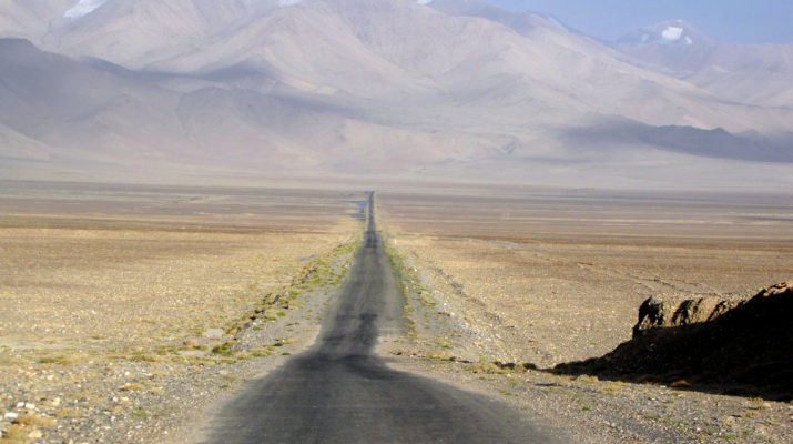
Some geological landscapes of Tajikistan
Your expert geologist for Tajikistan
PROGRAM
The most expedient option is to arrive in Osh city (the southern capital of Kyrgyzstan). Meeting at the airport. Hotel accommodation.
After breakfast, briefing at a hotel - presentation of the programme. A brief essay on the geology of the South Tien-Shan and the Pamirs. The geological boundary between the Tien-Shan and the Pamirs. After the briefing, excursion to the geological museum.
After lunch, excursions to UNESCO cultural heritage site, the famous mountain Sulaiman-Too. Further - free time. We recommend visiting one of the oldest markets (bazaar) in Central Asia. Overnight at the hotel.
In the morning - departure to the Pamirs, to its northern border - the detached Zaalai ridge (another name is Chon-Alai ridge). The route passes through the famous Pamir Highway, which was built by the USSR military forces, in order to defend the southern borders of the country.
Along the way, we cross alpine meadows, overcome high passes of the Alai Range, view impressive landslides near the area of highland town Gulcha, and drive along depressions composed of Mesozoic sediments. There we make a stopover 1 to see interaction of the Paleozoic (PZ) basement and geological layers of the Mesozoic age (MZ). Then we reach high mountain valley Alai (2500 m) which is an outcome of the interaction between the great mountain systems of the Tien-Shan and the Pamirs. Alai valley is a junction place of the Pamirs and Alai. There we make the stopover 2 in order to view and discuss the border between the Pamirs and the Tien-Shan.
Then, we stop at the climbers’ base camp (3500) under the Lenin peak (7134 m), at a zone of glaciers and moraines.
The journey proceeds through the Hercynian region of the Tien-Shan. Therefore, we try to understand the interaction between the Pamirs and the Tien-Shan. Define the basic tectonic mechanism of modern geological structure formations.
Thus, along the Pamir Highway, we move to the fundamentally different geological and geographical ambience of Central Asia. Overnight at the base camp is the stopover 3.
After breakfast, the path leads to the pass Kyzyl-Art (4280 m). After the pass, we find ourselves in the North Pamirs. The further route to a highland village Murghab is about 135 km long. The path passes through the highest mountain desert on Earth - Marcansu. The route road runs from north to south through Akbaital pass (4655 m) crossing tectonic zones of the Northern and Central Pamirs. Stopover 4 - we explore the Uybulak massif of triassic (T3) granites. Stopover 5 - the region at an altitude 4000 m. There is the highest mountain lake in the world, lake Karakul. There we learn about the origin of the lake, and see life of local people in harsh conditions. Stopover 6 - Akbaytal structure of scaly thrusts. Stopover 7 - the Precambrian (PR) metamorphic complex. At Stopover 8 we explore Pshart-type Jurassic (J) granites. Overnight in Murghab (3600 m).
The further route length from Murghab to Lake Bulunkul is 155 km. It is the East and Southeast Pamirs. Next, stopover 9 is to explore Beshgumbes ophiolite window. Next stopover 10 is to see Alichur granite massif. Next, stopover 11 is near the lakes Sysykkul and Shorkul. Then, stopover 12 is in the area of Lake Bulunkul-Yashylkul (3700 m). There we see Cretaceous quartz latites (K). Overnight at a hostel in Bulunkul village (3500 m).
The further route leads us to the Southwest Pamir. The way from Bulunkul village to Lyangar village is 125 km. We go through the Khargush mountain pass (4320 m), and see Khargush Lake and the Pamir River. Stopover 13 is to see Pamir metamorphites. Next stopover 14 is to study granites with rare metals. Stopover 15 is on the right bank of the Pamir River to explore Precambrian (PR) gneisses, amphibolites, and migmatites. We can see ancient petroglyphs in the area of Lyangar village. Overnight at a hostel in Hisor village (2500 m).
The further route from the Lyangar village to the Ishkashim village is 150 km. The Panj River originates there. The route path lies along the Panj River. On the left bank of the river is Afghanistan. There are to be several stopovers. At Stopover 16 we see again Pamir metamorphites. Stopover 17 - we visit Bibi Fotima thermal spring. During stopover 18, we see ruins of ancient fortresses Yamchun (Kafir-Kala) and Kakh-Kakh (III century BC). Stopover 19 is in granite area with rare-metal (Nb, Ta, Li) Cretaceous pegmatites (K). Overnight at a hotel in Ishkashim village (2550 m).
After breakfast, the way from Ishkashim to Khorog is 110 km. long. The road meanders along the Panj River. Stopover 20 at Kuhi-Lal noble spinel deposit. At stopover 21 we see travertines of Garmchashma thermal spring. In Khorog we make an excursion to the famous Alpine Botanical Garden named after Professor A.V. Gursky of Pamir Biological Institute of Tajikistan Academy of Sciences. The altitude of the Botanical Garden is 2300 m. Overnight at a hotel in Khorog (2000 m).
We proceed to the Western Pamirs. The way length from Khorog to the center of Darvaz district is 240 km. Stopover 22 - first 60 kilometers from Khorog, we observe geological formations of black schists of the Permian-Triassic age (PT), which break through Late Cretaceous (K2) granitoids. Stopover 23 - we study Cretaceous-Paleogene volcanics (KP) of Bartang volcanotectonic deflection. At Stopover 24 - we visit Rushan gneiss dome. Stopover 25 - we make a visit to Dashtak marble deposit. Stopover 26 at Kurghavat Precambrian (PR) tonalite-gneiss dome. Further the way we see suture zone ophiolites of the Darvaz Paleo-Ocean (C1). Overnight at a hotel in Darvaz village (1500 m).
After breakfast, the journey continues from Darvaz to Kulob town. The path is 170 km long, and most of the road runs along the Pyanj River. When crossing the southwestern spurs of the Darvaz Range, we fall into the South Tajik Depression. Stopover 27 - from Kulyab we go to Childukhtaron (translated from Tajik means “Forty Girls”) to contemplate the world of amazing landscapes of mountain forms. Return to a hotel in Kulyab.
The journey from Kulyab to Dushanbe passes through the South Tajik Depression. Stopover 28 at Khoja Mumin salt dome. Stopover 29 is at ancient city- fortress Khulbuk (2700 years). Stopover 30 at the reservoir of the Nurek hydropower station, which has the highest stone-filling dam in the world - 300 m. Distance from Kulob to Dushanbe is 200 km long. Overnight at a hotel in Dushanbe.
Dushanbe city is the capital of Tajikistan. It is a very beautiful city with hospitable residents. After breakfast a visit to the Shirkent Natural History Park, located on the southern slope of the Hissar Range. At Stopover 31 there are numerous traces of Jurassic dinosaurs in the area. Distance from Dushanbe to Shirkent is 90 km. After returning from Shirkent to Dushanbe, visit to the National Museum of History, Oriental Market "Mehrgon", a Gemstone Gift Shop. Further - free time, sightseeing of local attractions. Relaxation. Overnight at a hotel.
After breakfast, the way goes from Dushanbe to Aini village, which is 130 km long. We cross the Gissar Range through a tunnel named Istiklol, whose length is 5040 m. Stopover 32 at the tunnel at an altitude of 2650 m. Then we cross the Zeravshan Range. Thus, moving from south to north, we get into the South Tien-Shan. In the South Gissar zone we can observe the junction of the South Tien-Shan and the South Tajik Depression. Stopover 33 is to see spherical basalts of ophiolite association, the Gissar Paleo-Ocean, C1-2. Next Stopover 34 is the place where we can study granitoids of the Hissar batholith.
The journey continues through the Zeravshan-Gissar zone. To see Fan-Yagnob coal deposit is Stopover 35. Next, stopover 36 is at an antimony deposit. Stopover 37 is at a unique place where there is an interminable underground coal fire in Kukhi-Malik hole. Stopover 38 at the Lake Iskanderkul. Stopover 39 at the famous granite intrusion (C2-3). After a few kilometers is Stopover 40 at the Zeravshan intramountain depression. By the evening we reach Aini village, where we spend night at a campsite on the shore of Iskandarkul Lake.
After breakfast, the journey continues north to Khujand city. The drive takes about 170 km. The Turkestan ridge is to be crossed through a tunnel named Shahristan, its length is 5253 m. The tunnel is at an altitude 2765 m., where there is the Stopover 41 in the Turkestan-Alai zone. There we can see geological formations of the Cambrian (530-520 million years). At Stopover 42 we visit unique juniper forests of Shahristan. At Stopover 43 to the north, at the foot of the Turkestan ridge we study the Shakhristan Silurian (S) gabbro-diabase belt. At Stopover 44 we move to ophiolite melange of Kukh ridges. Stopover 45 - we end the day with a visit to an ancient city Ustrushan - 2500 years. Arrival in Khujand city - the northern cultural capital of Tajikistan. Overnight at a hotel.
We visit the sights of the city and its environs. The city situated on the Syr-Darya River. Stopover 46 is at the Kairakum reservoir - “Tajik Sea”. Stopover 47 at Hydropower station “Friendship of Nations”. Collision shoshoneites, latites and monzonitoids of a skarn tungsten ore field, (C3-P1). Return to Khujand. Stopover 48 - an excursion to the history museum. Stopover 49 at East Market Panjshanbe. Stopover 50 - drive to the Arbob architectural complex. Further - free time. Dinner and overnight at a hotel in Khujand.
After breakfast, we leave Tajikistan and set out to Kyrgyzstan going by a small town Isfara, located in the northern foothills of the Turkestan Range. The distance from Khujand to the border of Kyrgyzstan is 150 km. Further the route leads to Batken town. Overnight at a hotel in Batken town.
Visit to the geological heritage - Madigen Formations. After breakfast, we will visit the unique Mesozoic complex of the Sary-Too and Madigen mountains. Here, in the Triassic formations, the world's only paleontological finds were found. We will observe outstanding landscapes and historical sites. Return to Batken. Overnight at the hotel.
Distance Batken - Osh - 300 km. Overnight at a hotel in Osh city.
Transfer to the airport.
- - Meeting and seeing off at the airport
- - Transport according to the programme
- Accommodation according to the programme in 3 * hotels, guest houses and tents (for two)
- Full board meals
- Entry tickets to reserves according to the programme
- Guide
- Bottled water
- Entrance fees to museums and reserves
- - Single occupancy at a hotel.
- International flights
- Expenses entailed due to any changes to the programme
- Tips for the staff
- Personal expenses at hotels (international calls, bar, etc.) - - Visa
- - Insurance
Price by Request
Price depends on the number of participants
Our email: info@geoexplorersclub.com